
Sag Harbor Backyard Project (Study)
LOCATION: Sag Harbor Backyard
DATE: ongoing —> the future
TYPE: Study
We aim to connect the conversation about global climate, which can feel abstract, to our local reality, which is shared, experienced, and observed by all of us living here.
We believe the environmental crisis facing the east end of Long Island is real. Learning about our local history, present, and future, and clearly stating facts about this crisis, is the first step.
The Sag Harbor Backyard Project is this first step. It is an ongoing research/educational project that started in 2024 with a group of young adults from the Guild Hall Teen Arts Council and our design Studio.
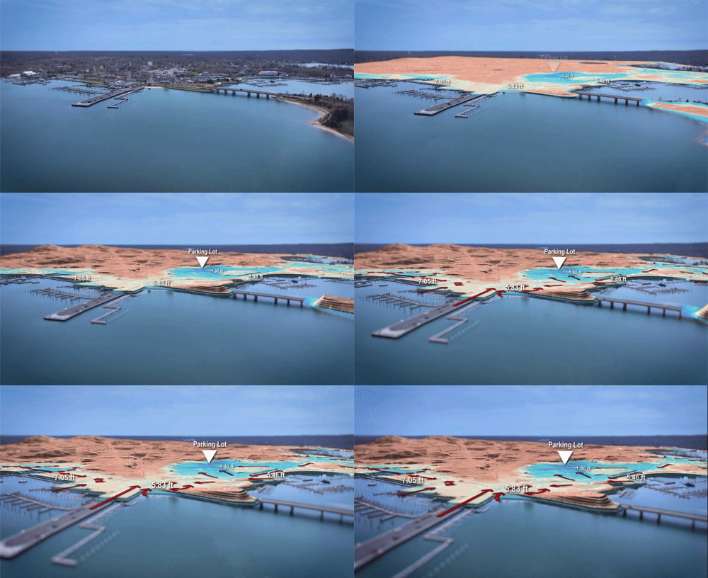
The goal of this project was to understand how Superstorm Sandy made landfall in October 2012 and to study how it affected Sag Harbor, and in particular what caused the severe flooding in the back parking lot adjacent to this project. - An area we called Sag Harbor’s backyard.
This was a community effort - we worked with local surveyors, civil engineers, meteorologists, historians, and village officials. Among other things, we learned that Sag Harbor's settlement created topographical features that, along with its unique hydrology, created the conditions for the severe flooding that we have experienced here and are likely to experience more of in the future.
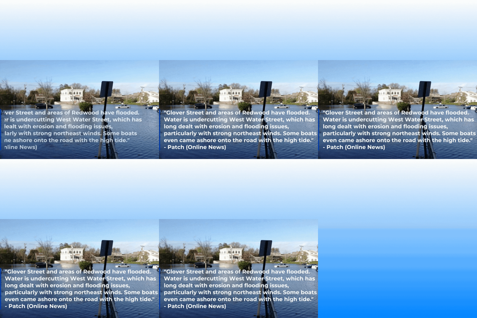
HURRICANES AND FLOODING
Centered around the idea that “the past is prologue,” Studying how the hurricane came ashore, and how it impacted the local environment, can give us a roadmap for how to prepare for the next one (which will come).
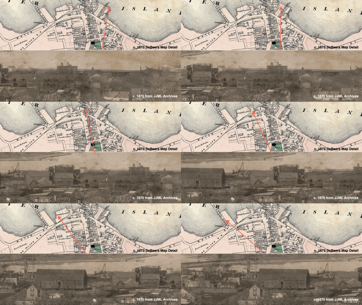
HISTORY
Sag Harbor’s Backyard, the portion west of Main Street, is ever-changing, and extremely susceptible to flooding given its high groundwater levels and proximity to the ocean. It’s easy to believe that this is simply how things are, but part of our project is to demonstrate how the earliest settlement of Sag Harbor, in the 1700s, directly links to how it is managed today.
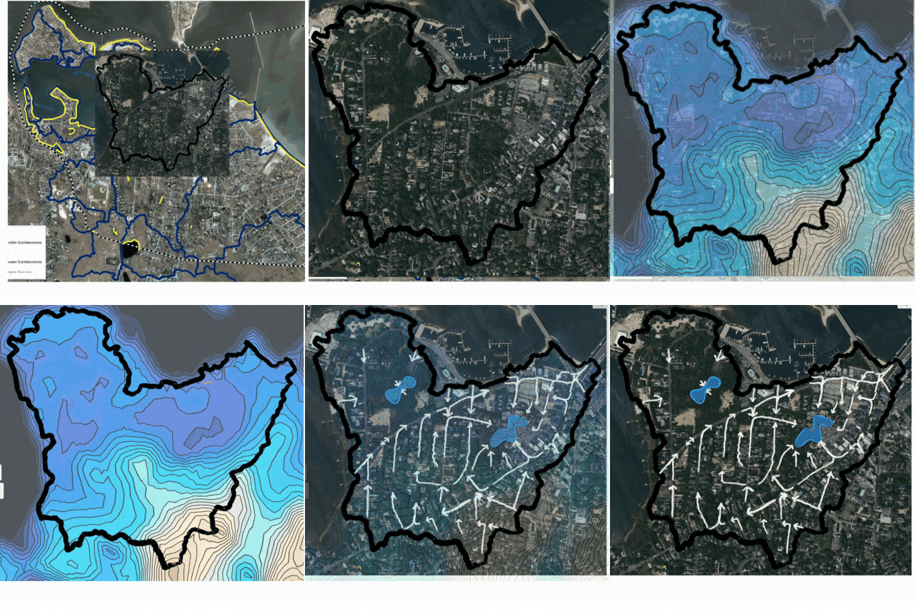
THE FUTURE
Resilience and revitalization are not only possible but necessary. We are entering an era of climate resilience, and believe that properly and carefully managing the Backyard will be central to a successful and sustainable Sag Harbor.

WHAT’S NEXT?
What we do with this parking lot portends the future of Sag Harbor, and begins to be part of a roadmap for resilience. Taking this opportunity seriously gives us the chance to see how resilient our communities really are, and how important it is to take every opportunity to decrease catastrophic environmental impacts and increase our longevity in this extraordinary part of the world. One idea proposed by students is centered around George the duck - and giving back his pond.